
Bringing ‘greener life’ to Bahrain
TDT | Manama
The Daily Tribune – www.newsofbahrain.com
Reported by Ashen Tharaka
The Bahraini government has begun to pay significant attention to the issue of food security in response to the impact that the greenhouse effect and global warming are having on climate change.
Specially in the green economy, technological initiatives are crucial to achieving the Kingdom’s 2030 vision. In order to address the problems the Kingdom is having with planting, the Information & eGovernment Authority (iGA) has launched a number of projects.
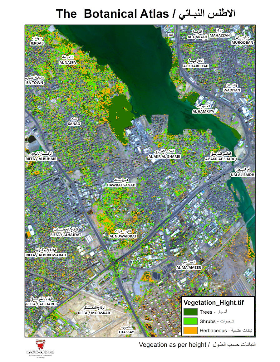
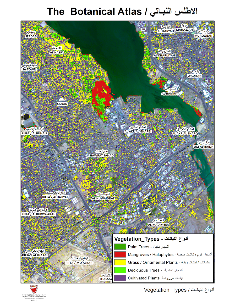
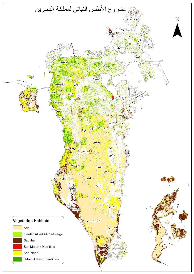
These projects focus on mapping the geospatial locations of countries’ vegetation — the Botanical atlas — is one of the important results of that effort. The Botanical atlas project contains maps pertaining to the vegetation cover in Bahrain, with various classifications, such as the types of agricultural crops, and their areas and locations.
This project employs satellite imagery, remote sensing techniques and Artificial Intelligence (AI), to derive intelligent information and it utilizes remote sensing data from the Sentinel-2 satellite operated by the European Space Agency, with a spatial resolution of 10 meters to collect analyse, identify, and classify vegetation data in the Kingdom, as well as using field surveys to produce spatial information.
iGA made this great initiative with main goals to measure and classify the vegetation health, identify and classify vegetation habitats, in addition to the classification of the vegetation as per their types and height in the Kingdom.
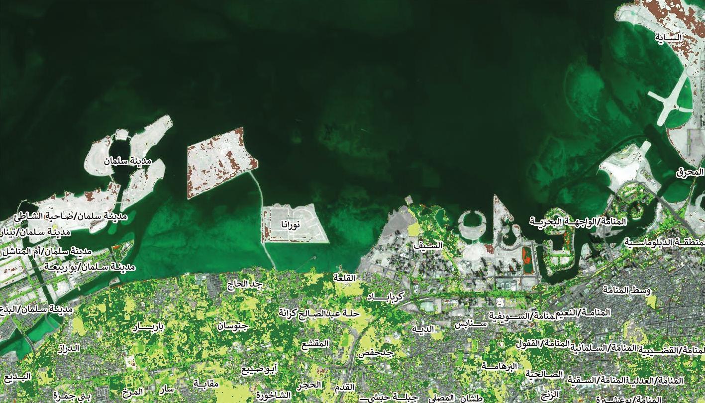
Speaking to The Daily Tribune, Fathi Al Burshaid, Chief of Spatial Information and Remote Sensing in iGA, said: “According to the map, the western part of Bahrain is fully green and this map will be available for public reference in the near future.
“The map shows the vegetation height in Bahrain under three main categories such as: Trees, Shrubs and Herbaceous. Other maps cover the types of agricultural habitats such as: gardens, parks, shrubs, salt marshes, muddy areas and sabkha areas.
This is in addition to identifying the types of vegetation cover such as trees, shrubs, and herbaceous plants.” He added that the project was completed by iGA within one year to be one of the key systems that support the agriculture development of the Kingdom and the Sustainable Development Goals.

Plant Biomarkers project
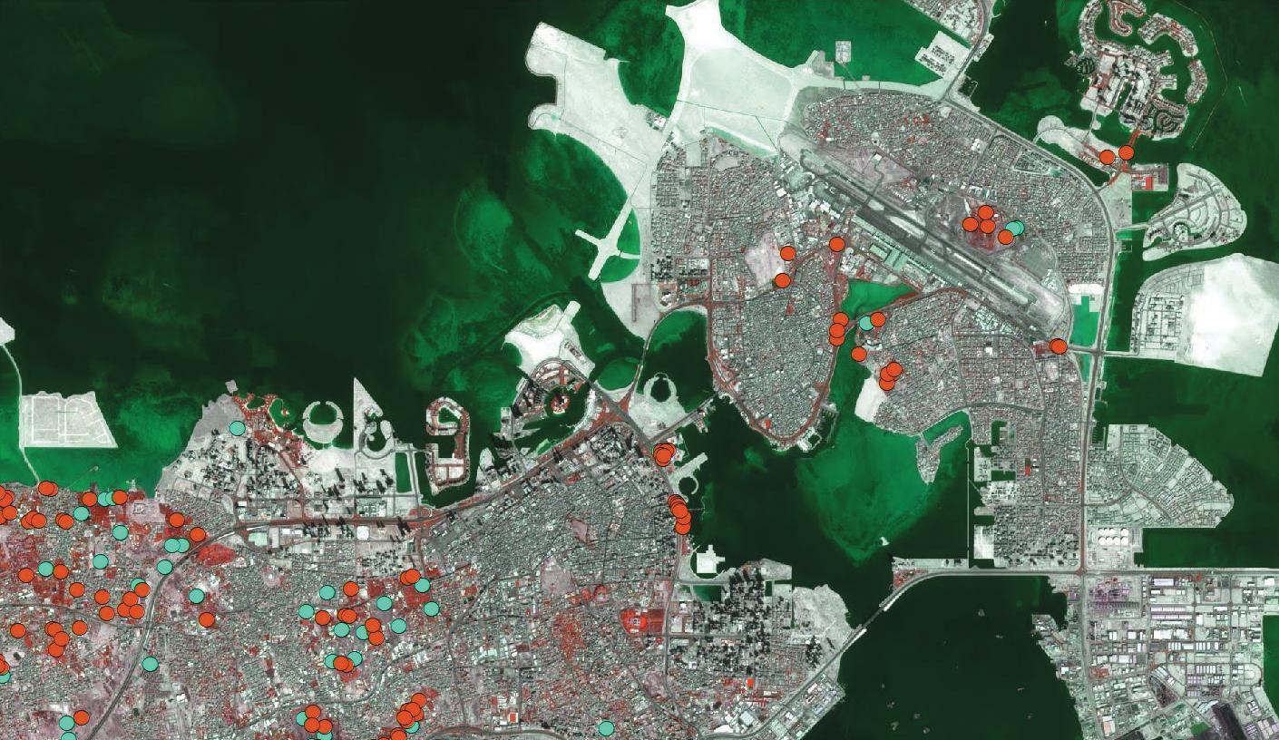
The Plant Biomarkers project is one of the key agriculture projects that is developed by iGA. It employs remote sensing and Geographic Information Systems to obtain detailed information about vegetation coverage in the Kingdom.
The implementation of this project contributed to the production of 48 detailed maps of plant biomarkers at a rate of 12 maps for each indicator during 2019, and the identification of areas that plants suffer from lack of water throughout the year.
This project helps to identify the vegetation with shortage of leaf water content which can indicate problems with the irrigation and other outputs such as the vegetation chlorophyll and nitrogen leaf content have been identified.
The most important output of this project is measuring the plant’s health index in the Kingdom by measuring the vitality and greenness of vegetation cover and the extent of chlorophyll concentration in it, which is one of the most important components of the plant health index.
Soil maps project
Soil maps project is another agriculture project in the Kingdom developed by iGA, in which it relied on multispectral satellite images, remote sensing techniques and field surveys to produce maps of the agricultural characteristics of the soil.
iGA has implemented this project to identify agricultural areas and areas suitable for construction and provide soil maps to government agencies through the national geographic information base platform.
Green Bahrain
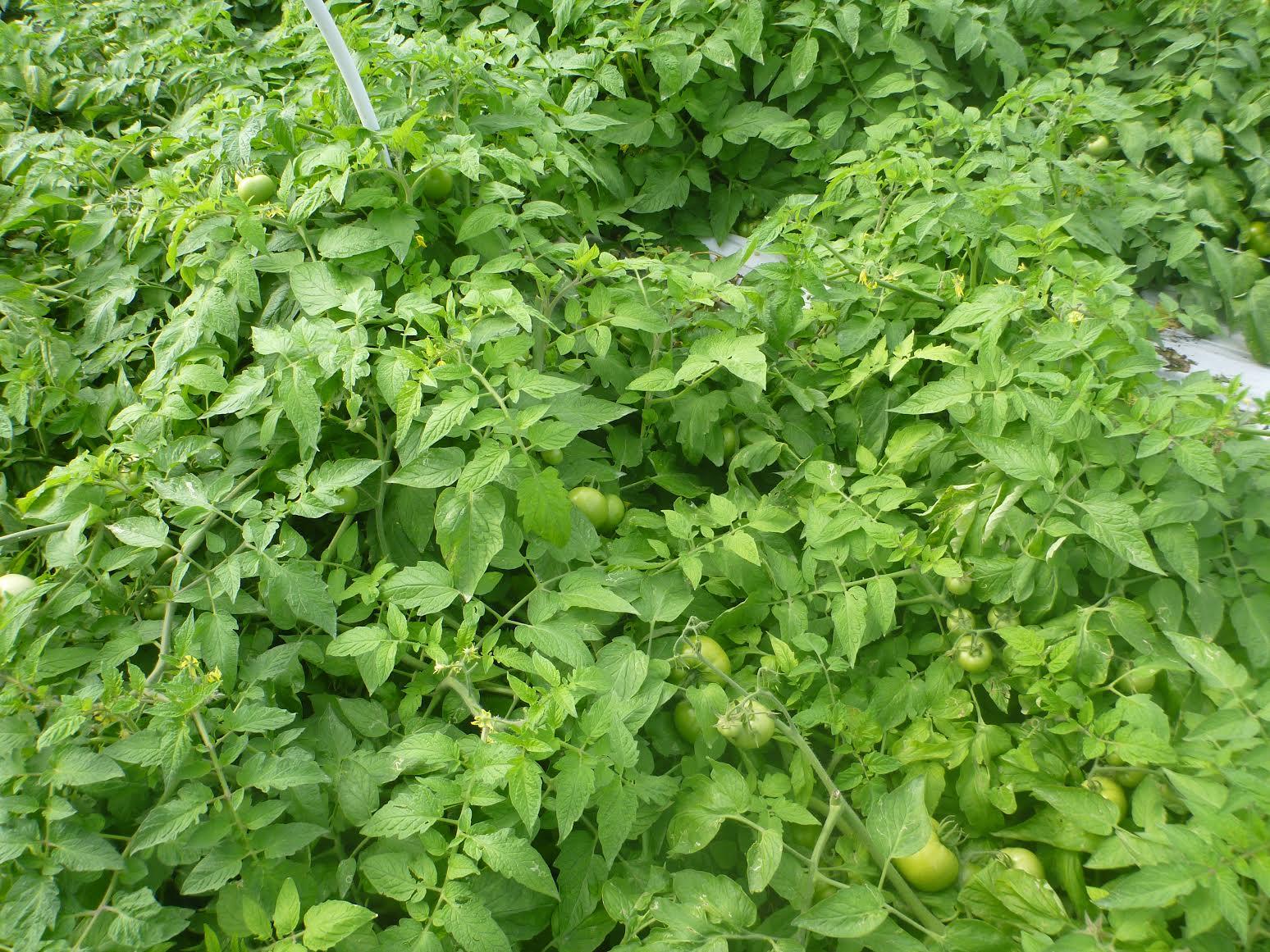
Meanwhile, Green Bahrain is blooming near Salmabad with more than 25 varieties of vegetable crops which produced more than 1,000kg of crop to the market.
Bahrain has already begun green planting to meet the country’s demand, and farmers are working hard to ensure the best harvest possible.
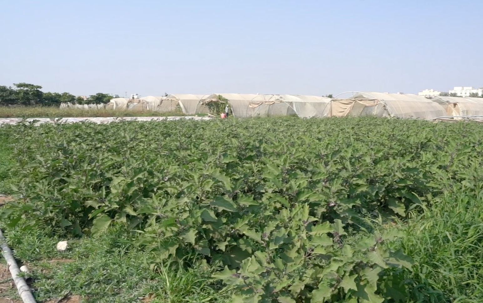
Alnoaimi Fields is a farm which is located in Salmabad where a six-acre vegetable farm provides harvest to the market each month. Their mission is to bring a greener life to your doorsteps, while being part of Bahrain’s booming development through the latest cutting-edge technology and committed to getting the job done as effectively as possible.
Bahrain is on its way to becoming a fully green country in the near future, with all of the latest technology being used in agriculture.
Related Posts