Marine areas in Bahrain get their ‘habitat maps’
Arecent study has come out with Benthic Habitat Maps for the marine area of the Kingdom, using remote sensing and field survey data and geographic information systems.
The study, funded by the Arabian Gulf University, was conducted in collaboration with the Supreme Council of Environment, Bahrain, and four SCUBA divers from Al Malkhia Rovers, and an academic and specialist from the Arabian Gulf University.
A fulbright visiting researcher within the Remote Sensing Research Lab at the University of North
Carolina-Wilmington, Dr Sabah Aljenaid, is finalising the remote sensing and GIS components of the study.
Though marine environment constitutes 91 per cent of the total area of the Kingdom, the ecosystems suffer a decline in their estimated area and quantity and quality of their habitats, because of the increase in the natural and human pressures.
The study focused on using two basic methods: remote sensing data and field survey data. The first phase of the study focused on the field surveys of the Bahrain marine environmental habitats surrounding the main islands of the Kingdom. More than 175 points were collected from all the islands. Four Scuba divers participated in the survey that was conducted in 30 days during nine months between October 2014 and June this year.
The final classification map revealed that the marine habitats of the Kingdom consist of deep water (2418 sq.km) algae (949 sq.km), sand (1228.4 sq.km), deep water/sand (1206 sq.km), rock (1522 sq.km) seagrass (627.8 sq.km) and coral (275.50 sq.km).
Apart from Aljenaid, Eman Ghoneim, Ghadeer Khadim, Mohd Abido, Wisam EL-Deen Mohd, Khalil Al Wedhai, Saeed Mansoor, Nader Abdel Hameed, AbdNabi Hilal and Ahmed Khateem were part of the study.
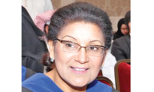
Photo Caption:
Dr. Sabah Aljenaid
Related Posts

